CARTOGRAPHY & VISUALISATION
Map Gallery
Finished maps from my projects, plus an interactive map of every study area. A good map has to carry the analysis on its own, and these cover GIS, remote sensing, and coastal change.
Finished Maps
Static maps made in ArcGIS Pro and Google Earth Pro. Each one is built so the main finding reads in a glance.
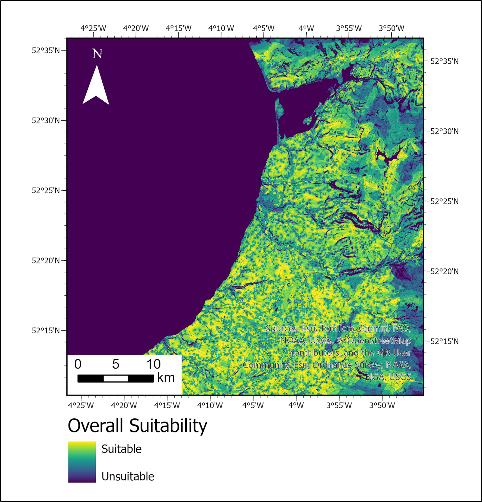
Hospital Site Suitability · North Ceredigion
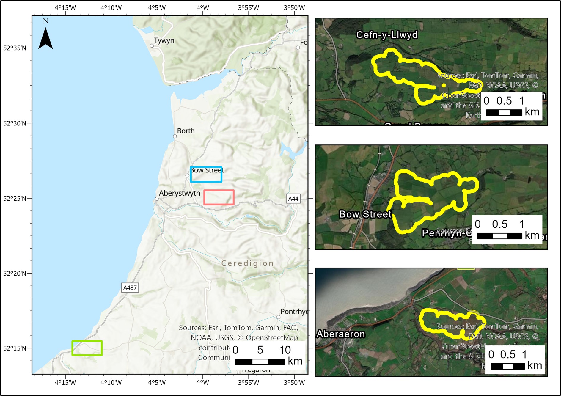
Candidate Sites A, B & C · North Ceredigion
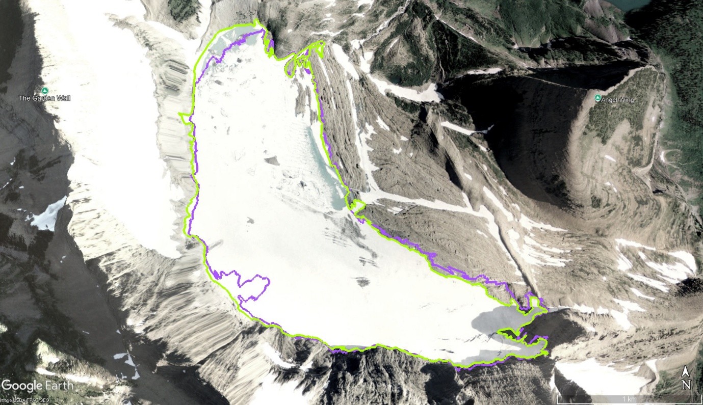
Grinnell Glacier · Boundary Change 2009 vs 2016
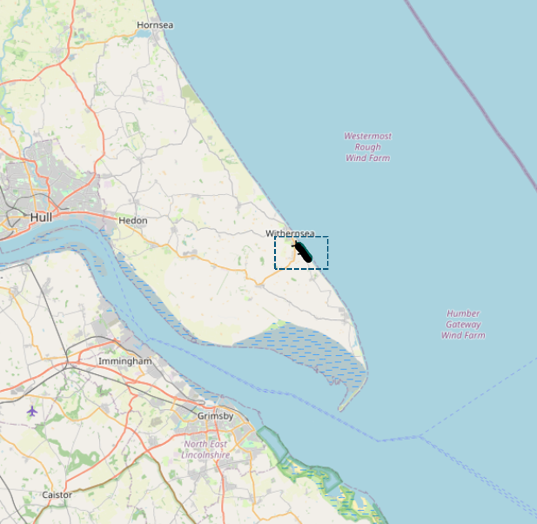
Cliff Erosion Study Area · South of Withernsea
DSAS Transects & 20-Year Prediction · Withernsea
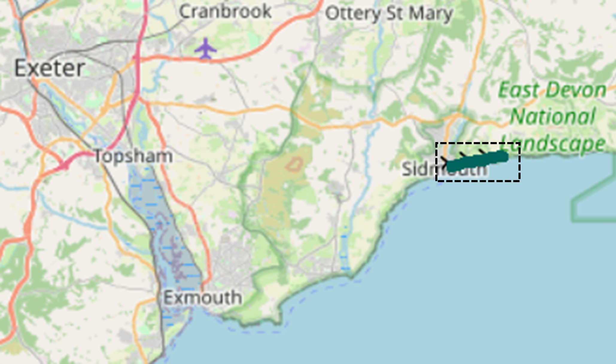
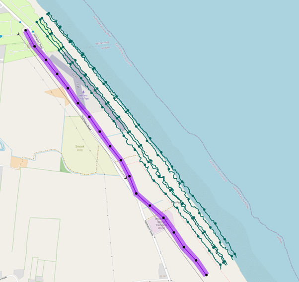
Cliff Erosion Study Area · East of Sidmouth
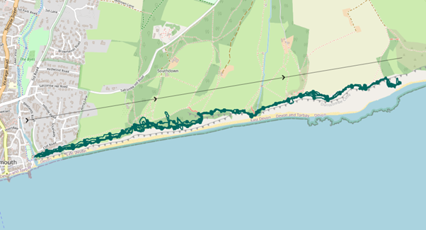
DSAS Transects · East of Sidmouth

Stream Network Pipeline · River Dovey

Watershed Delineation · River Dovey
Interactive Web Map
The study areas behind my projects. Click a marker for details. Built with Leaflet.js.
Markers show the study areas behind the projects on this site. Click the map to enable scroll zoom.